Aid Workers, Humanitarian Aid Support
Spokane wildfire appeal · Published 3 August 2026 · Updated 11 August 2026
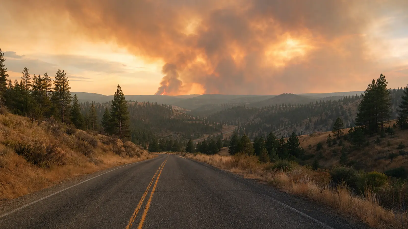
Smoke rising above dry pine-covered hills and a rural road

Emergency support after mass evacuations

Spokane communities need support as recovery begins and fire danger remains.

An official report on 11 August listed 774 structures lost and 9,932 acres burned across the Old Trails, Autumn Lane and Fairview fires. Evacuations and closures remained in effect while containment improved to between 73 and 97 percent.

  • 774 structures lost in the official 10 August morning report
  • 9,944 acres burned across three major fires
  • Evacuations and closures remained in effect
  • Containment ranged from 23 to 37 percent

Crisis timeline

How the emergency and response have developed

Verified events are kept in reverse chronological order. Older entries remain visible as relief, containment and recovery continue.

  1. Containment rises sharply across the three Spokane fires

    The National Interagency Coordination Center reported Old Trails at 3,176 acres and 73 percent containment, Autumn Lane at 5,764 acres and 89 percent containment, and Fairview at 992 acres and 97 percent containment. Reported structure losses were unchanged at 569, 149 and 56 respectively, a combined 774. Old Trails and Autumn Lane still had evacuations and area, road and trail closures in effect, while Fairview showed minimal fire behaviour.

    Source: National Interagency Coordination Center Incident Management Situation Report

  2. Containment improves across all three Spokane fires

    The National Interagency Coordination Center reported the Old Trails fire at 3,176 acres and 53 percent contained, the Autumn Lane fire at 5,776 acres and 73 percent contained, and the Fairview fire at 992 acres and 53 percent contained. Acreage for Old Trails and Autumn Lane was reduced after more accurate mapping. The report listed 569 structures lost at Old Trails, 149 at Autumn Lane and 56 at Fairview, a combined 774 that corrects the earlier combined figure. Moderate fire behaviour continued, with evacuations and area, road and trail closures still in effect.

    Source: National Interagency Coordination Center Incident Management Situation Report

  3. Containment rises across all three Spokane-area fires

    The National Interagency Coordination Center reported 10,002 acres burned and 812 structures destroyed across Old Trails, Autumn Lane and Fairview. Old Trails was listed at 3,226 acres and 43 percent containment, Autumn Lane at 5,784 acres and 61 percent containment, and Fairview at 992 acres and 43 percent containment. Moderate fire behaviour continued, with evacuations and closures still in effect and residences and critical infrastructure threatened. The lower Old Trails acreage reflected more accurate mapping.

    Source: National Interagency Coordination Center Incident Management Situation Report

  4. Containment improves while evacuations and threats continue

    The National Interagency Coordination Center reported a combined 10,363 acres burned and 812 structures destroyed. Old Trails was listed at 3,561 acres and 23 percent containment, Autumn Lane at 5,810 acres and 37 percent containment, and Fairview at 992 acres and 31 percent containment. Evacuations, closures and threats to residences and infrastructure remained.

    Source: National Interagency Coordination Center Incident Management Situation Report

  5. Official report raises confirmed structure losses to 812

    The National Interagency Coordination Center reported that Old Trails, Autumn Lane and Fairview had burned a combined 10,436 acres and destroyed 812 structures by 07:30 MDT. Old Trails was listed at 5 percent containment, while Autumn Lane and Fairview were each at 13 percent. Moderate fire behaviour continued, numerous residences and critical infrastructure remained threatened, and evacuations and closures were still in effect.

    Source: National Interagency Coordination Center Incident Management Situation Report

  6. Official report records 707 structures lost across three fires

    The National Interagency Coordination Center reported that Old Trails, Autumn Lane and Fairview had burned a combined 10,546 acres and destroyed 707 structures by 07:30 MDT. All three were listed at zero percent containment at that morning snapshot, and evacuations and closures remained in effect. Later that day it was reported that crews had established containment lines around all three perimeters, while evacuation zones remained because hotter, drier and breezier weather was forecast.

    Sources: National Interagency Coordination Center Incident Management Situation Report and credible reporting

  7. Mass evacuations continue as three major fires remain uncontained

    It was reported that the Old Trails, Fairview and Meadowview fires had forced about 60,000 people to evacuate. At least 600 homes, businesses and other structures were destroyed, about 12.5 square miles had burned, and all three fires were reported at 0% containment.

    Source: Credible reporting

  8. Emergency shelter and disaster-relief support remain active

    The American Red Cross reported operating shelters in Washington as wildfire conditions forced people from their homes. It was reported separately that about 400 people were at the Spokane Convention Center shelter on Sunday. The organisation's disaster-relief appeal remained active for wildfire response.

    Sources: American Red Cross and credible reporting

  9. Washington declares a statewide wildfire emergency

    The Governor of Washington declared a statewide emergency as dangerous fire conditions and active wildfires placed communities, homes and critical infrastructure at risk. State resources were mobilised to support local response.

    Source: Office of the Governor of Washington

  10. Local emergency authorities expand evacuation information

    Spokane County emergency authorities maintained public evacuation information and live mapping as fires threatened communities across the county. Residents in affected zones were directed to follow official alerts and leave immediately when ordered.

    Sources: Spokane County Emergency Management and Spokane Regional Emergency Communications

Verified emergency facts

A fast-moving disaster with major human impact

These figures are dated snapshots from the official 11 August morning report. Evacuation zones, containment and damage totals can change quickly as crews assess affected areas.

774

structures lost

The official total combined 569 structures at Old Trails, 149 at Autumn Lane and 56 at Fairview.

9,932

acres burned

The official report combined 3,176 acres at Old Trails, 5,764 at Autumn Lane and 992 at Fairview after updated mapping.

3

major fires still active

Evacuations and area, road or trail closures remained in effect at Old Trails and Autumn Lane in the official 11 August morning report.

Why help matters now

Evacuation is only the beginning of recovery

Families leaving at short notice may need shelter, food, medicine, transport, clean clothing and reliable information. People returning later can face damaged homes, lost possessions, disrupted work and continuing smoke or fire risk.

The American Red Cross has confirmed active sheltering and disaster-relief fundraising for people affected by wildfires. Its response demonstrates a legitimate and continuing public appeal connected to this emergency.

This AidWorkers.com campaign is independent. Cited organisations are evidence sources and are not presented as partners or recipients of donations to AidWorkers.com.

Read the Aid News report on the Spokane wildfires for the event-level evacuation, containment and recovery record.

Conditions can change rapidly. This page will keep dated updates without removing earlier verified snapshots.
  • Emergency shelter and essential supplies for displaced families
  • Trusted public information as evacuation zones change
  • Preparedness for further fire spread and new evacuations
  • Responsible recovery support where it can be properly authorised
  • Ongoing monitoring after immediate fire activity declines

Donation transparency

What this campaign does and does not promise

Urgency should never come at the expense of honesty. This page separates verified disaster facts from AidWorkers.com's own role.

Your donation can support

  • Monitoring and publishing verified wildfire information.
  • Practical crisis, preparedness and field-focused resources.
  • Due diligence, coordination and response-readiness work.
  • Authorised direct or partner support connected to the emergency where feasible and properly controlled.

What we will not imply

  • That AidWorkers.com is a US emergency authority or is endorsed by any source named below.
  • That a gift has reached Washington or a named organisation unless that transfer is confirmed.
  • That fast-moving evacuation, damage and containment figures remain unchanged.

Check the evidence

Sources used for this appeal

Impact, response activity and evidence of active public fundraising were checked before publication. Fast-moving claims are dated and attributed in plain text.

  • National Interagency Coordination CenterIncident Management Situation Report with updated acres, structure losses, containment and closures · 11 August 2026, 07:30 MDT
  • National Interagency Coordination CenterIncident Management Situation Report with updated acres, structure losses, containment and closures · 10 August 2026, 07:30 MDT
  • National Interagency Coordination CenterIncident Management Situation Report with updated acres, structure losses, containment, threats and closures · 9 August 2026, 07:30 MDT
  • National Interagency Coordination CenterIncident Management Situation Report with updated acres, structure losses, containment, threats and closures · 7 August 2026, 07:30 MDT
  • National Interagency Coordination CenterIncident Management Situation Report with updated acres, structure losses, containment, threats and closures · 6 August 2026, 07:30 MDT
  • National Interagency Coordination CenterEarlier Incident Management Situation Report retained for the timeline · 5 August 2026, 07:30 MDT
  • Credible reportingLater 5 August containment-line and evacuation update · 5 August 2026
  • Credible reportingEvacuations, structure losses, burned area, containment and shelter use · 3 August 2026
  • Spokane County Emergency ManagementOfficial emergency information and public safety directions · checked 3 August 2026
  • Spokane Regional Emergency CommunicationsOfficial evacuation mapping and active public alerts · checked 3 August 2026
  • Office of the Governor of WashingtonStatewide emergency declaration and wildfire resources · 1 August 2026
  • National Interagency Fire CenterNational incident reporting and wildfire operational context · checked 3 August 2026
  • American Red CrossSheltering, wildfire response and active disaster-relief fundraising · checked 3 August 2026
Is this an American Red Cross or government appeal?

No. This is an independent AidWorkers.com campaign. The organisations above are cited only as sources for emergency facts or evidence of active public fundraising. They are not presented as partners or recipients.

Will every donation be sent directly to Washington?

No such claim is made. The campaign supports AidWorkers.com's wildfire-related humanitarian purposes, including verified public information, practical resources, response readiness and authorised direct or partner support where feasible. Any confirmed transfer or delivery should be reported separately and transparently.

Why can the figures change?

Evacuation zones can expand or contract, containment changes and damage assessments continue. Figures on this page are dated so later updates can be added without erasing the historical record.

First published: . Last fact-checked: .